The landscape
A desert made of stones: what the Agafay is
Why the desert outside Marrakech has gravel instead of dunes, what a reg and a hamada are, and what the Atlas adds to the view.
See this evening's dates ↗Quick answer
The Agafay is a stony desert, a reg, not a sea of sand. Wikivoyage describes a rocky landscape of pale hills with the High Atlas behind it, and Wikipedia defines a reg as a surface of tightly packed pebbles and cobbles left when wind carries off the fine material. Expect gravel, dust and long views, with no dunes to climb.
Desert landforms in plain words
| Term | What it means | Why it matters on the evening |
|---|---|---|
| Reg | A desert surface covered with packed rock fragments | Firm ground for quads and camels, and dust when they pass |
| Hamada | A hard, rocky, mostly barren plateau | The wide, flat horizons you see in photographs |
| Erg | A large field of shifting sand dunes | Not found at the Agafay |
| High Atlas | The highest part of the Atlas Mountains | The snowy skyline in winter |
What a reg is
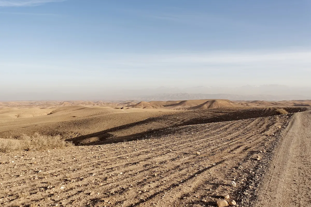
Wikipedia's article on desert pavement says the surface is covered with closely packed, interlocking angular or rounded rock fragments of pebble and cobble size. It lists reg as the name used in the western Sahara, and hamada as the term for a related surface in the western Sahara and the Middle East. The usual explanation is that wind and occasional rain slowly remove sand, dust and other fine material and leave the larger fragments behind, which then settle tightly together. Geologists still debate exactly how these pavements form, and Wikipedia says so. The practical result is a hard, even floor, which is why vehicles and animals cross it so easily.
The neighbouring landform: hamada
A hamada is a related landscape. Wikipedia describes it as a type of desert of high, largely barren, hard rocky plateaus from which most of the sand has been removed by deflation, and notes that the majority of the Sahara is hamada. It is related to desert pavement but occurs as highland plateaus rather than stony plains. That difference explains why the Agafay is better described as a reg, a stony plain, than as a rocky plateau, even though both words describe bare rock.
Why there are no dunes
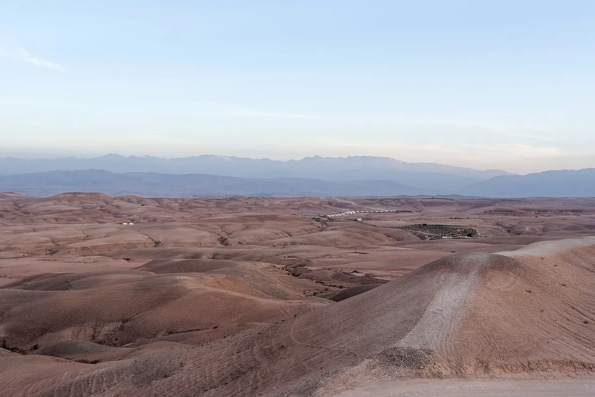
Dunes belong to ergs, which Wikipedia describes as large areas of shifting sand dunes and contrasts with hamadas. The Agafay is not one of them. Wikivoyage says as much, calling it a reg, not an erg, and describing a moon-like terrain of rocky ground with white hills. If you picture orange dunes at sunset, that picture belongs to places a long way further into the Sahara. What the Agafay offers is a different beauty: low rounded hills in ochre and pink, tracks winding between them, and a very large sky.
The Atlas behind the plain
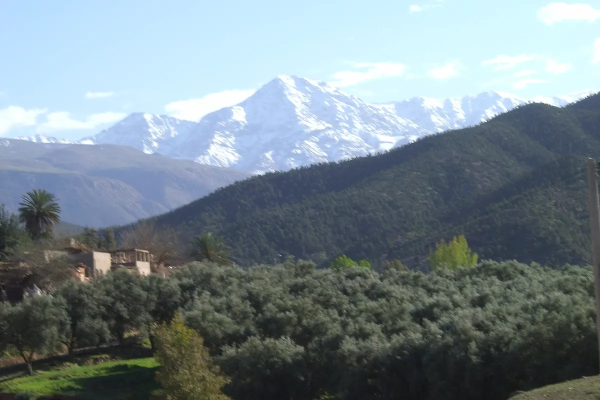
Wikivoyage places the High Atlas in the background. Wikipedia describes the High Atlas as the highest part of the Atlas Mountains, rising in central Morocco, with Toubkal as its summit at 4,167 metres. It adds that snow falls regularly at higher elevations and lasts well into late spring, mostly on the northern faces. That is why a winter or spring photograph of the desert can show a white skyline, and why the evening air cools quickly. It also means the mountains are a backdrop, not part of the ride.
Reading the ground as you ride
When you are on a camel or a quad, a few things are worth noticing. The ground is not smooth. Wikivoyage mentions rocky terrain and hard ground, and the photographs on this site show gravel, tracks and scattered stones. Stones kick up under wheels, and a camel's pads grip well on rough, firm ground but not on slippery, wet ground, as Wikipedia says of the dromedary's feet. Dust travels fast and far, so a scarf or buff is useful. Nothing here is hazardous in itself, but it is not a beach.
What to carry
Wikivoyage's advice for the Agafay is simple: the sun is fierce in the day, so bring a hat, sunglasses and high-factor sunscreen; nights cool sharply, so bring a jacket; and carry bottled water at all times. Add closed shoes for dust and stones. These are practical rather than dramatic points, but they are the difference between a comfortable evening and a tiring one.
Frequently asked questions
Is the Agafay a real desert?
Yes, in the sense that it is dry and sparsely vegetated, but it is a stony desert, not a sandy one.
What is the difference between a reg and a hamada?
Wikipedia describes a hamada as a high, rocky plateau and a reg, or desert pavement, as a stony plain or depression.
Will the mountains be visible?
Wikivoyage places the High Atlas in the background. Haze and weather decide how clear the view is on the day.
Sources
- Desert pavement on Wikipedia, for reg and how stony surfaces form
- Hamada on Wikipedia, for the plateau landform
- Agafay Desert on Wikivoyage, for the terrain and practical advice
- High Atlas on Wikipedia, for the mountains and their snow
- Atlas Mountains on Wikipedia, for the wider range
- Dromedary on Wikipedia, for how camels cope with rough ground